Engravings of the year 1621
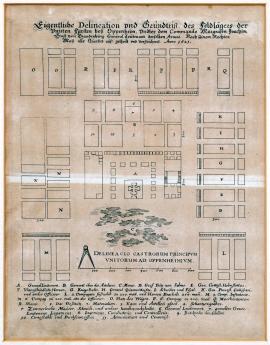
The actual map and layout of the field encampment of the allied princes close to Oppenheim under the command of the margrave Jáchym Arnošt of Brandenburg, general lieutenant of the same army. All accommodations in 1621 are divided and mapped according to the correct dimensions.
It is a schematic plan of the military camp in symmetrical squares. At the front is a swamp under which is the measuring scale. Over the picture part of the printing is the above text, under which are legends: A-R and 1-11. This sketch is a significant document for the war history of the 17th century since it accurately depicts the organization (local) of the military encampment. The printing depicts accommodation, battle, administrative premises, the intendancy stocks, etc.
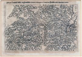
A picture of the Veltlin countryside taken from the Spanish by the French general marquis di Covure.
The engraving depicts the territory northwards from the Como lake along the Addy valley in the today’s province Sondrio. On the right side of the picture is the lake Como. The whole countryside is scattered with mountains with countless identifications of various places. Over the picture are the cited text and the legend.
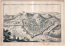
A picture of Inhringen enclosed with George Frederick margrave Badensky’s chances in 1621.
The small picture depicts the hilly countryside on the foot of which is the fortified town Ingringen. There are the chances depicted among various hillocks. In the background are the towns of Brysach and Höhingen. At the front are several trees and two musketeers. Over the picture is the text stated above.
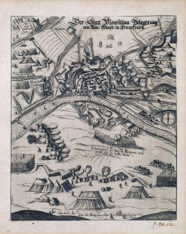
The siege of Montalban by the French Majesty.
The engraving depicts the fortified town (from above) at the bank of the river Tar (correctly: Tarn). The correct name of the besieged town is Montauban. The town lies in the Tarn et Garonne department. At the left corner there is the king’s main tent depicted on the hill. The above inscription is stated on the engraving.
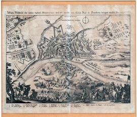
A true picture of the fortified town of Montauban besieged by the French Majesty in 1621.
The front side of the picture shows the groups of soldiers and buglers. There is the river Tarn flowing in the centre of the countryside. On its bank there lies the fortress Montauban. On the left near the river Lauarion is the king’s main tent – Pique Cox. Under the engraving is legend 1-13.
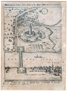
Depiction of Stein cellar in Electoral Palatinate which lies above Rhein.
It is a small high-altitude painting with the Rhein river with a bridge across it. A ship is painted on Rhein and Rhein-Türkheim lies on the shore. The upper part of the paintings shows the Stein castle, encircled with a water course and swamps. There is a Spanish camp, chances and various trees in the landscape. Above the painting, there is the aforementioned text, and below the painting is a legend.
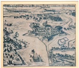
A picture of the fortress Nové Zámky besieged by the army of His imperial Majesty under the command of the general Buquoy.
The engraving maps the fortress Nové Zámky with five advanced chances and surrounded by water. From the fortress shots are being fired at the emperor’s camp located on the left. In the background behind the town, the riders clashed. On the right is the river Nitra. At the right bottom corner is a four-edge cartouche with a view of Bratislava. In the background are hills.
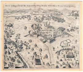
A sketch of the fortress Nové Zámky besieged by His Majesty’s army under the command of the general Burquoy.
The engraving depicts the fortress Nové Zámky in 1621. Except for the missing view of Bratislava, the graphics is nearly identical with sheet No. 38/170 on page 35. Only the riders’ clash is somewhat differently conceived. It is undoubtedly the fight in which Buquoy died. According to Drugulin G. Keller, both engravings are undoubtedly created by the same author and have the same dimensions.
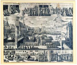
Execution decided and carried out on 11/21 June 1621 in Prague.
The picture is divided into seven parts depicting various events associated with the conviction and execution of 27 Czech lords in the Old Town Square. The depicted episodes represent the pronouncement of the judgment, the presentation of the petition for pardon by the convicts’ wives and children, the convicts are transported in covered carriages to the Old Town Square Hall, the bloody execution on its own and the Old Town Square bridge tower to which the heads of the executed persons and the Jesenius’s tongue were fastened as a warning.
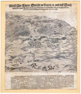
A picture of the field camps of His prince Majesty, duke of Bavaria, etc. and Mansfeld’s camp as they lay opposite each other close to Rozvadov in Bohemia and close to Weidhausen in Upper Palatinate in 1621.
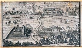
Imperial earthwork close to Damgarten.
It is a small picture, probably cut out from some work (maybe Theatrum Europaeum), with no specific time indication. It depicts riders with flags. On the left are the fortified tower and the river Regnitz across which a way is leading to the fortified camp with soldiers. In the background is fire.
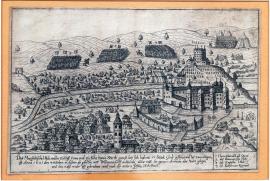
Mansfeld’s army with 5,000 riders and 13,000 foot soldiers had 17 cannons and 2,000 wagons, arrived on 4 October 1621 in the depicted place of Willhelmsdorf, stayed there overnight and started to march towards Lower Palatinate on the 5th day of the same month.
In the picture is the town of Willhermsdorf upon Aurach lying 34km northwestwards from Norimberk, and the castle Bürckmischling with “Lusthaus” on the hill overgrown with grapevine. The river Aurach splits close the town into two arms, of which one flows around the castle that is the water stronghold. Over the castle is the coat of arms, undoubtedly owned by the family of the then holder. Both inside and around the town is the camping army. In the background are 4 military troops structured in the distinctive square shapes. The above text and legend 1-4 are under the picture part of the printing.
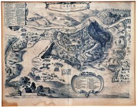
The town of Tabor besieged in 1621.
The etching is made masterfully. However, based on the style, it is not made by Hollar but rather by Sadeler and is not signed. Tabor is depicted from above, the church tower is partially demolished and on the left is the pond Jordan. Around the town are military groups, chances, incursions, etc. Everything is engraved with an astonishing accuracy and carefulness. The cited inscription is over the picture. At the bottom is an extensive legend on a decorative vignette field.
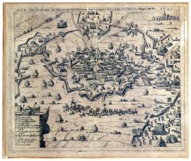
A picture of the town of Frankental besieged by the deputy general Don Goncal Ferdnand de Cordova in 1621.
The town is painted from above. A short way off, the riders have clashed. On the left is Rhine and on the right is a forest with a small village and the church tower. Around the town are banks and chances. The trajectories of the cannon shots are depicted by curves. At the bottom on the left is a decorative cartouche with legend A-L.
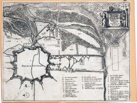
The siege of the town of Frankenthal in 1621.
The picture depicts only the fortification facilities around the town of Frankenthal, the remaining part is empty. The flow of the river Rhine is depicted in the forest countryside. On the right side up there is a decorative cartouche with two figures of Fidelitas and Constantia, on which are the coats of arms and the above inscription. Under the picture of the printing are legends A-R and 1-12.


